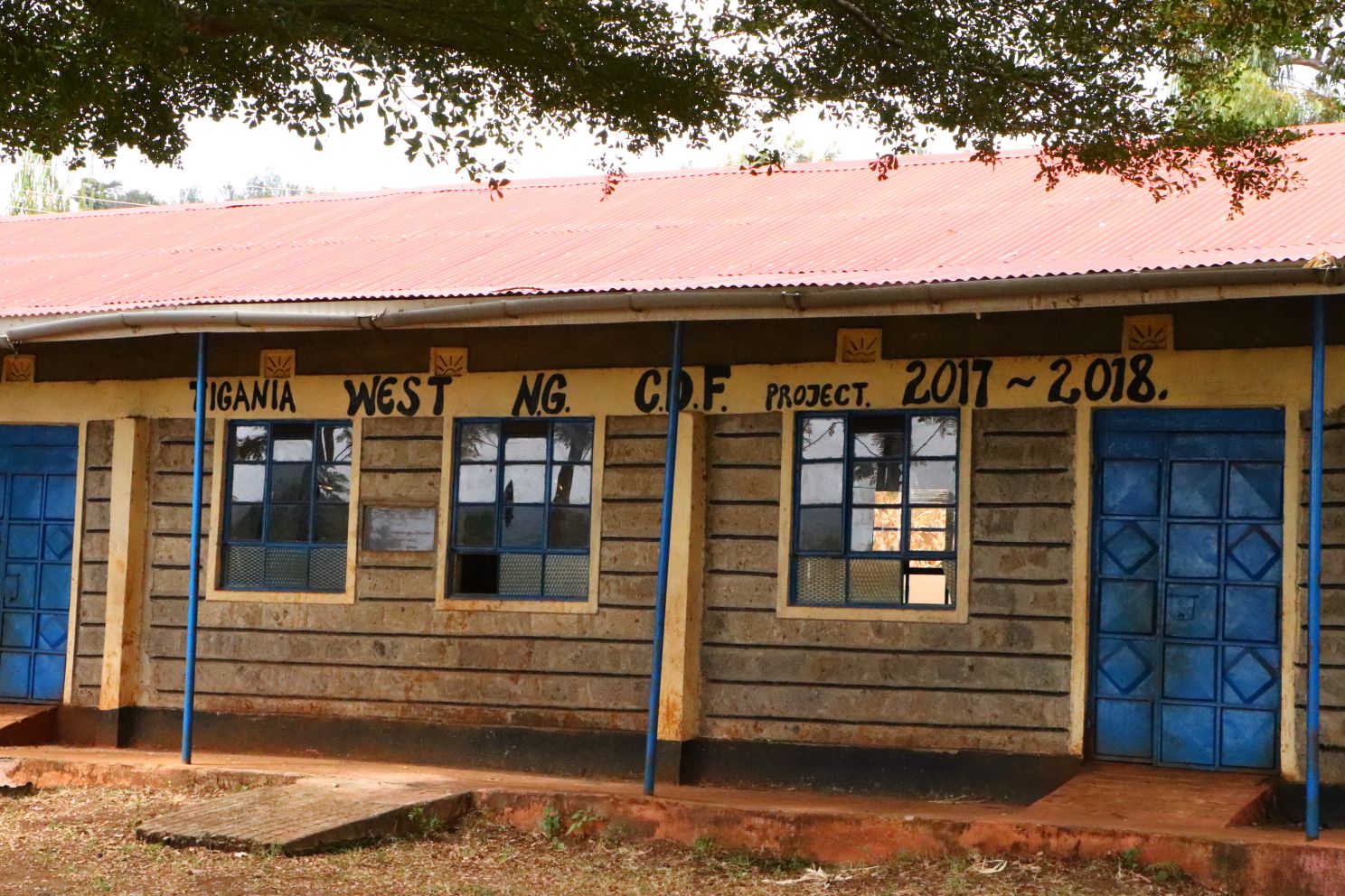
About Us
Tigania West Constituency
Location and Size
Tigania West Constituency is majorly rural located in Meru County in the former Eastern Province. Tigania West Constituency borders Tigania East to the East, North Imenti to south, andBuuri to the West.Tigania West also borders two counties namely:TharakaNithi County to the South-East and Isiolo County to the North-West. It is only 13km from Meru Town, the Meru County headquarters. Tigania West constituency covers an area of 455km2. The Constituency was established by the then Electoral Commission of Kenya for the 1997 elections, and has so far been represented in Parliament by the following individuals: the late Hon. Benjamin Ndubai (1997-1999), the late Hon. Stephen Mukangu (1999-2002), the Hon. Dr. Kilemi Mwiria (2002-2013), the Hon. David Kariithi (2013-2017), and the Hon. Dr. John K. Mutunga (2017 onwards).
Demographic Features
According to The Kenya National Bureau of Statistics (KNBS) report of 2013, Tigania West Constituency had a large population of 135,980 people. The population of Males was 64,981 while that of females was 70,999. Therefore, the Gender Index (women to men) was 1.09. There were over 29,810 households in the constituency with an average household size of 4.56. The constituency had64,114 registered voters as per the Independent Electoral and Boundaries Commission (IEBC) records of 2017. Assuming the national annual population growth rate of 2.6%, then the population of Tigania West by end of 2017 should have been 154,600. The same population by the end of 2022 should be around 175,772. The increasing population requires adequate planning to ensure that the quality of life is not compromised.
Administrative and Political Units
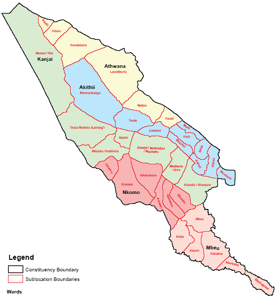
Tigania West Constituency has five (5) wards namely: Akithii,Athwana, Kianjai, Mbeu, and Nkomo. Kianjai ward is the most populous with a population of 36,874 people as per the 2013 KNBS report. Kianjai ward covers an area of approximately 126.50km2. Kianjai ward has 16 sub-locations namely: Kiandiu, Ithamare, Miathene, Antubeiga,Urru, Kianjai, Mutionjuri, Machaku, Nairiri, Muthiru, Mituntu, Kalithiria, Thau, Lairang’i, Mumui and Rei. It is followed closely by Akithii ward with a population of 35,646 and occupying approximately 74.10km2. Akithii ward comprises of 10 sub-locations including: Mweronkanga, Twale, Limbine, Maanthi, Karii, Mwili, Kaliati, Ntiba, Kitheo, Mucuune.The third most populous ward is Nkomo with a population of 24,361 and covering an area of approximately 53.90km2. It has 6 sub-locations namely: Limauru, Kunene, Kilenchune,Amwari,KamarooandNtombo. The fourth most populous ward is Mbeu ward with a population of 20,972 and an area of approximately 51.00km2. Mbeu ward has 7 sub-locations including: Kaboto, Machegene,Kiorimba, Kibuline,Kimirii, Kieru andMbeu. The least populous ward is Athwana with a population of 18,127. However, Athwana ward is the most expansive with an areaofapproximately 149.60km2. Athwana ward has6 sub-locations namely: Ntulili, Kibiru, Kandebene, Lachiathuuriu, Matiru and Kuani. The Tigania West Constituency Map showing the administrative wards is shown below:
Access NG-CDF Information on your Mobile


County Assembly Wards in Tigania West Constituency :
Akithii Ward
- County Assembly Ward No.:
- County Assembly Ward Name: Akithii
- County Assembly Ward Population (Approx.): 481.1
- County Assembly Ward Area In Sq. Km (Approx.): 74.10
- County Assembly Ward Description: comprises part of Mweronkanga, Limbine, Maanthi, Karii, Mwili, Kaliati, Ntiba, Kitheo, Mucuune and Twale
Athwana Ward
- County Assembly Ward No.:
- County Assembly Ward Name: Athwana
- County Assembly Ward Population (Approx.): 121.2
- County Assembly Ward Area In Sq. Km (Approx.): 149.60
- County Assembly Ward Description: comprises part of Ntulili, Kibiru, Lachiathuuriu, Kuani, Matiru, and Kandebene
Kianjai Ward
- County Assembly Ward No.:
- County Assembly Ward Name: Kianjai
- County Assembly Ward Population (Approx.): 291.5
- County Assembly Ward Area In Sq. Km (Approx.): 126.5
- County Assembly Ward Description: comprises part of Kiandiu, Ithamare, Miathene, Antubeiga, Kianjai, Mutionjuri, Machaku, Nairiri, Mituntu, Kalithiria, Urru, Thau, Muthiru, Lairang’i, Mumui and Rei
Mbeu Ward
- County Assembly Ward No.:
- County Assembly Ward Name: Mbeu
- County Assembly Ward Population (Approx.): 411.2
- County Assembly Ward Area In Sq. Km (Approx.): 51.0
- County Assembly Ward Description: comprises part of Kaboto, Kiorimba, Machegene, Kieru, Kibuline, and Kimirii
Nkomo Ward
- County Assembly Ward No.:
- County Assembly Ward Name: Nkomo
- County Assembly Ward Population (Approx.): 452.0
- County Assembly Ward Area In Sq. Km (Approx.): 53.9
- County Assembly Ward Description: comprises part of Kunene, Limauru, Kilenchune, Ntombo, Kamaroo and Amwari